Aerial data you can build on.
Take Flight 360 delivers drone stockpile measurement, volumetric surveys, and aerial mapping for Florida's construction, aggregates, and industrial operations — survey-grade numbers, without the survey-grade wait.
Free site assessment · Response within 1 business day
From flight plan to figures your team can act on
Guesswork on inventory, slow manual surveys, and crews climbing piles cost you money and expose you to risk. We replace all three with automated drone capture and engineered data deliverables.
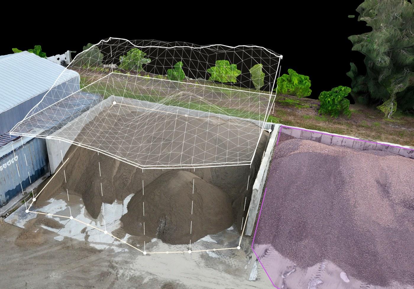
Volumetric Stockpile Analysis
Precise volumes, tonnage conversions, and cut/fill — with trend tracking across recurring flights so inventory variance stops surprising you.
Automated Mapping & Surveys
Orthomosaics, topographic data, and contour maps flown on repeatable DroneDeploy missions — the same site, captured the same way, every time.
3D Models & Site Monitoring
Point clouds, digital surface and terrain models, and as-built vs. design overlays that keep earthworks and schedules honest.
Measured from above. Trusted on the ground.
Traditional stockpile measurement means crews on unstable material, days of downtime, and volumes that can swing 10–20% from reality. A single automated flight captures your entire yard in minutes — and the math is repeatable.
- Inventory numbers your accountants and auditors can stand behind
- No personnel on piles, slopes, or active haul roads
- Deliverables in Excel, CAD/BIM, and Procore-compatible formats
Built for operations that move material
Concrete plants, quarries, contractors, municipalities — anywhere inventory, earthworks, or site progress drives the bottom line.
Concrete & Aggregates
Monthly inventory reconciliation without shutting down the yard.
Construction & Heavy Civil
Progress tracking and earthworks verification against design.
Mining & Quarries
Pit, bench, and stockpile data without stopping production.
Municipal & Public Works
Salt and sand stockpiles, infrastructure, and storm documentation.
Know your numbers before the next reconciliation.
Tell us about your site and we'll scope a flight plan, deliverables, and a recurring program that fits your operation.